1993). Click figure for larger image.
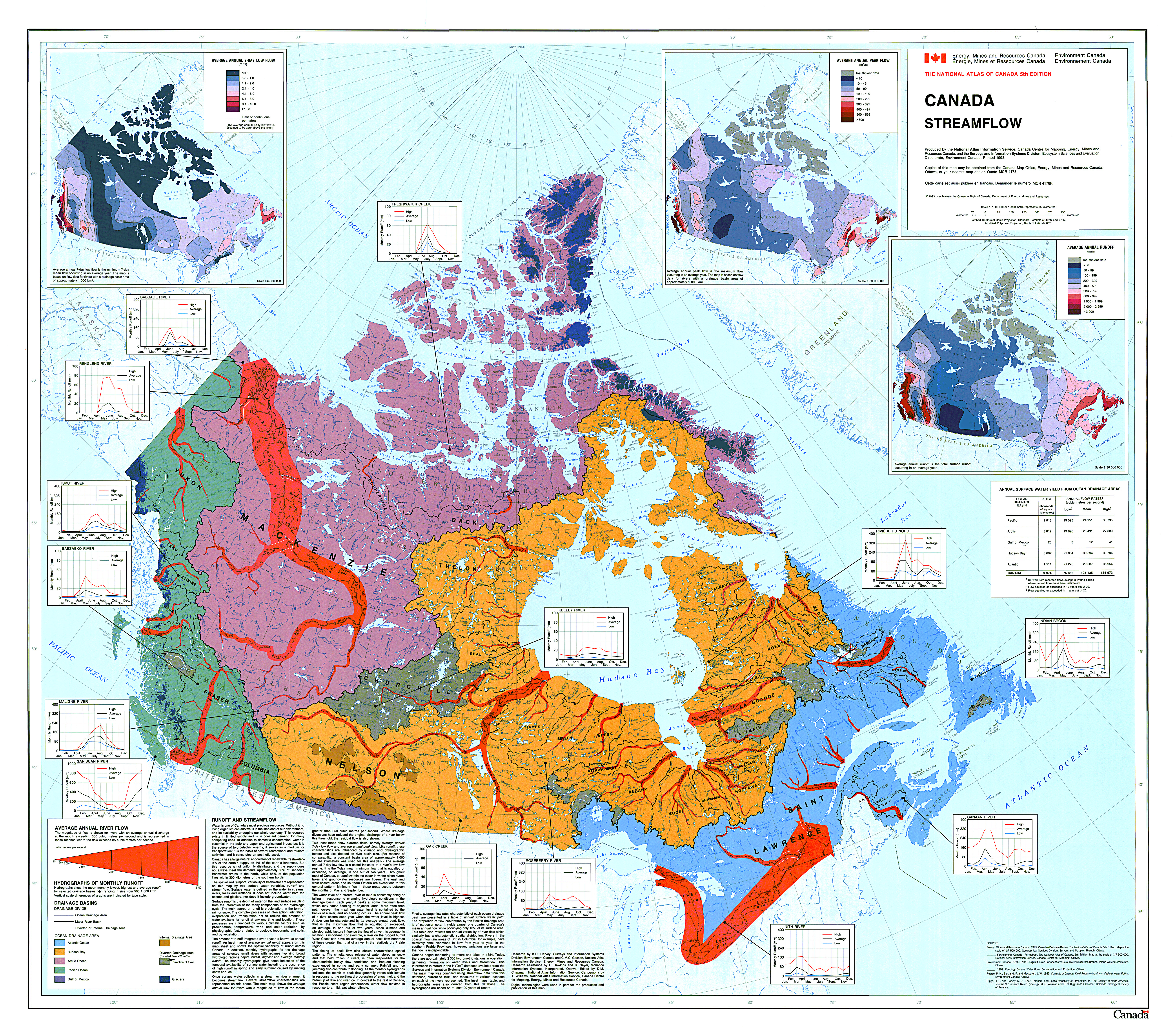
Almost 1/10 of the world’s freshwater is located in Canada, much of which is transported by Canadian rivers through the vast hydrological network (Figure 1). Canada’s drainage basin area is 9,974,000km2, with flow rates between 75,000 to 135,000m2/second. Moreover, the entire Arctic drainage basin area is 3,812,000km2 with flow rates ranging between 14,000 to 27,000 m2/second. River drainage in Canada flows into the following drainage areas: Atlantic Ocean, Hudson’s Bay, Arctic Ocean, Pacific Ocean and the Gulf of Mexico. Up to 60% of Canada’s total river drainage discharges in a northwards direction. Peak river run-off usually occurs between May and August in the Canadian Arctic, correlating with seasonal river ice melt and break-up. This peak flow varies spatially across Canada, following the 0° isotherm responsible for river ice formation and thaw. Peak flow occurs earlier in southern regions, where ice-free seasons are longest in duration (Environment Canada, 1993).
Within the last 40 years, river flow and discharge have altered slightly across Canada. The seasonal maximum flow (Figure 2) has increased in central Canada, and in a few areas along the west and east coastlines. In contrast, significant decreases in maximum river flow has occurred widely along both coastlines and along the Rockies. Moreover, some changes in minimum flow have also occurred (Figure 3). Largely minimum flow has increased across the west and central portions of the country, with significant decreases in minimum flow along the eastcoast, southern British Columbia and throughout Manitoba. More than 3000 monitoring stations are located in rivers across Canada to monitor these temporal changes (Environment Canada, 1993; Monk et al., 2010; DeBeer et al., 2016).
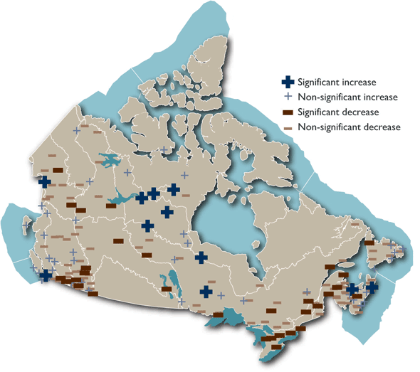
Figure 2: Maximum river flow change
between 1970-2005 (Monk et al., 2010)
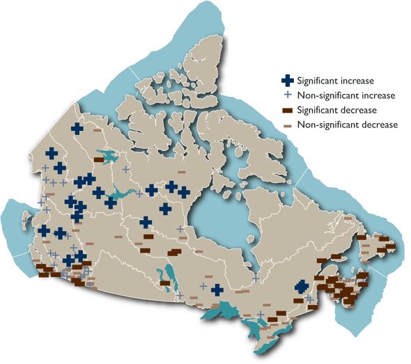
Figure 3: Minimum river flow change
between 1970-2005 (Monk et al., 2010)
Material on this page was provided by Thomas Bergeron and Yves Gauthier, Institut national de la recherche scientifique and edited by Maren Pauly and Tristan Mills, Department of Geography, University of Waterloo.