The Community Collaborative Rain, Hail and Snow Network (CoCoRaHS) - Canada sites
According to CoCoRaHS, this program is: "a unique, non-profit, community-based network of volunteers of all ages and backgrounds working together to measure and map precipitation across Canada. By using low-cost measurement tools, stressing training and education, and utilizing an interactive website, our aim is to provide the highest quality data for natural resource, education and research applications."
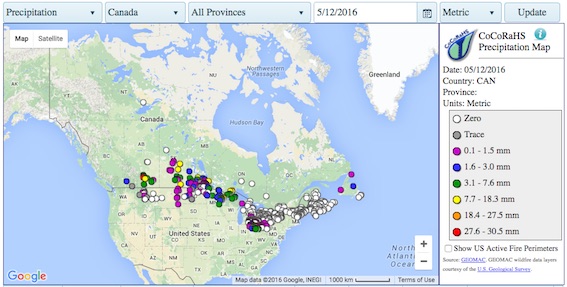
Data and imagery provided by the Community Collaborative Rain, Hail and Snow Network (CoCoRaHS). Click on points for station information.
Snow Tweets
The Snow Tweets project offers realtime updates of snow depth data from community observers around the world using social media for data collection. The following Snowbird data mapping application visualizes snow depth spatial variation, layering community tweets with satellite snow data. See the Canadian Snow Research page for more details.
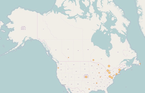
Data and imagery provided by the Snow Tweets Project. Click on map to view snow data mapped in real time using the Snowbird Tool.
References
Snow Links
Material on this page was edited by Maren Pauly, Department of Geography, University of Waterloo.