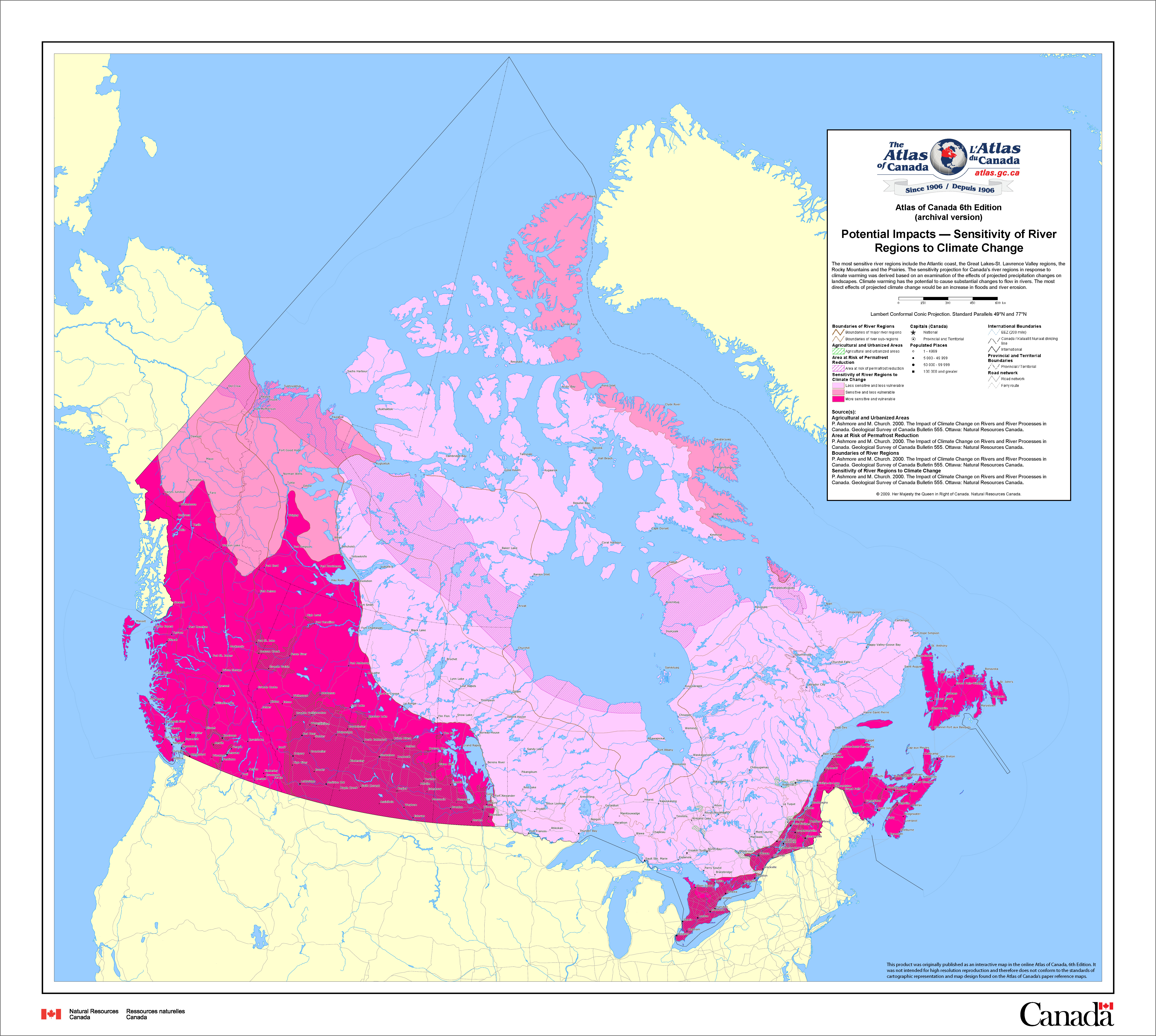
in Canada. Sensitivity levels in pink (deeper colour indicates
higher severity), agricultural areas in green stripe, permafrost
reduction risk areas in pink stripe and river boundaries in
brown (Environment Canada, 2009).
Future changes in river ice within Canada is a function of projected changes in temperature and precipitation. Potential changes will affect Canada heterogeneously, with the highest sensitivity being in the westcoast, through the southern Prairies, southern Ontario and along the east coastline (Figure 1). Future changes are expected to be mainly caused by the altered river flow regimes and seasonality differences. In particular, river floods are expected in the sensitive regions, with likely erosional consequences. The Prairies and east coast have extensive agricultural regions, which would be devastated by flooding. Additionally, many populated areas are located in these parts of the country, including major cities such as Toronto, Ottawa, Vancouver and Quebec. Regions along the north coast and around Hudson's Bay are at a lower risk of river impacts. However, these regions have higher risk of permafrost thaw, which may induce changes in the river systems (Environment Canada, 2009; Fu, Yao, 2015).
Material on this page was provided by Maren Pauly (Department of Geography, University of Waterloo).